 |
Vinci A9140Research Campus Expansion |
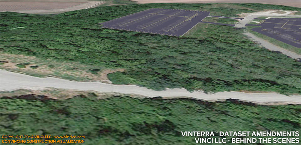
Vinci LLC · Behind the Scenes | VinTerra™ Digital Terrain Model Dataset Amendment.
Vinci LLC’s VinTerra™ digital terrain modeling service incorporates public and project specific topographic data. Project specific data is the most preferable kind, because of its accuracy. Some datasets do feature flaws, either in the input or in the conditioning. When an audience sees this sort of flaw, however “accurate” you say the DTM was, they enter into cognitive dissonance with your assertion. Flaws like this distract an audience and can corrupt their overall impression of your construction services.
Vinci LLC takes care to amend the dataset where necessary, so as to minimize interference with your construction message. The wavy road at the start of this example is obviously not as bumpy as the model conveys. Where construction activity would potentially engage the roadway or where it may be visible and distract the audience, Vinci LLC smoothed the dataset so flat roads show flat, banking roads show smooth.
This page last modified Wednesday 6 August 2014.