
Featured Links
Vinci LLC
5106 Hampton Avenue
Suite 205
Saint Louis, Missouri 63109-3115
T. 314-351-7456
C. 314-614-6578
mike@vincico.com

Ever want to “pop the hood” and show your audience what’s underground? Vinci LLC has three ways to make it happen. All three ways are collectively referred to as Vinci™ SubVision™. Given a survey you provide, Vinci can indicate existing or planned underground utility work. Some of Vinci’s most successful visualizations involve showing your audience you know how to handle what lurks below. We can get to the bottom of tricky enabling work, helping you explain why some things need to happen before we dig, for instance. SubVision™ can also show how your construction company endeavors to avoid existing utilities or underground obstructions. SubVision™ can be used to simply indicate your company is aware of what lurks below. In sum, SubVision™ is all about subsurface conditions.
Click here for more about each of the three kinds of Vinci™ SubVision™. »
Not every project will require Vinci™ SubVision™. Greenfield endeavors, places where there are no significant utility systems are certainly not candidates for the feature. Vinci has used SubVision™ on approximately half of its projects. SubVision Solid™ has played an instrumental role in clinching “Ivy League” research and academic projects and wet infrastructure installations. If you desire to get involved on infill or campuswide work a major university, medical, research, or industrial campus, check out Vinci™ SubVision™, and see what’ underground!
Note that Vinci LLC does not produce or intend to produce construction documents; only a qualified engineer of the appropriate trade can provide these. All Vinci™ SubVision™ services are intended to be deployed during construction marketing or early-stage shows or graphics merely to communicate generalities of the project. Vinci™ SubVision™ is not appropriate for use as construction documents.
Click here for a brief description of the Vinci™ General Construction Sequence™. »
Click here to return to the Vinci LLC home page »
Vinci™ SubVision™ Types

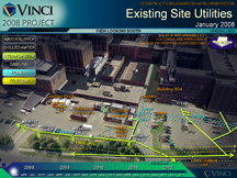
Vinci™ SubVision Solid™. Some projects are intertwined with existing systems of underground objects, like steam tunnels, chilled water lines, underground vaults, and storm and sanitary sewer systems, to name a few. These systems can be every bit as important as the neighboring buildings, especially on university, medical, and research campuses. If you have civil data, Vinci LLC can produce visualization showing the approximate location of both planned and existing items to remain or be demolished. Show them how your bank retention responds to it, how you will avoid interrupting service (given the civil data is thorough) and how you’ve phased utilities to get into that tricky foundation fast, so you can finish before the other guys say they can. SubVision Solid™ is an optional part of the Vinci™ Digital Worksite™, so it can appear anywhere you determine it’s necessary to show.
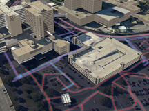
Vinci™ SubVision X-Ray™. This quick view of underground utilities is produced in the early to middle phases of project development.
It is part of the model, so it can be made to appear at any point in the presentation stream. Use SubVision X-Ray™ when site utilities
are more significant to your project, but not paramount. SubVision X-Ray™ is also handy for large areas;
entire campus underground utilities can be rendered visible using this underground view. (SubVision X-Ray™ requires Vinci™ Digital Worksite™ contextual terrain modeling).
Click here to see examples from Project A8306 »
Vinci™ SubVision Trace™. The simplest manifestation of SubVision™ is applied late in the production process and takes the least effort to display.
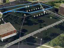
Use SubVision Trace™ to selectively indicate individual utility lines for those complex or densely packed corridors. SubVision Trace™
is also handy when you don’t need an exhaustive visual explanation of underground utilities, but feel you need to communicate the basics about them.
Click here to see examples from Project A7B33 »
Other Vinci™ Construction Visualization Options
Vinci™ SubVision™ is normally a part the introduction to the Vinci™ General Construction Sequence™. This sequence is a bird’s eye view of the entire project or significant portions thereof, showing construction phasing, logistics, and schedule throughout the span of the project. Vinci can incorporate aerial photography, photomontaging output from the model to produce a schedule sequence from that photograph’s viewpoint. The results can be lifelike. The average quantity of images ranges from half to a couple dozen. Vinci™ GCS™ is ideal for projects where one viewpoint is sufficient to support your strategy. Multiple Vinci™ GCS™ can be prepared from Vinci™ Digital Worksite™ (DWS™) projects.
Click here to return to the Vinci LLC home page »
About this website
This page was last modified 24 March 2010.
This website and all images are copyright © 2010 Vinci LLC, all rights reserved.

