 |
Vinci A76B6Design-Build Industrial Training Center |
Tweet |
Vinci Construction Vignette | Design Build Location Strategy
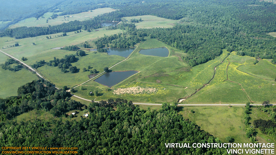
Vinci LLC’s client Mike asks, “we need a way to show a 100-year flood plain, let’s use a USGS map and shade it in using PowerPoint.” So Vinci takes the oblique aerial photo and the USGS map, superimposing one on the other, then paints in the nearly-Biblical inundation seen above. This image proves in a single animation that Vinci’s client is keenly aware of greenfield site constraints and has a plan to avoid them. Mike’s impressed; a couple days later so is the Owner audience. This image was instrumental in the clinching of the job.
This page last modified Sunday 13 November 2011.