Vinci SubVision™
Subsurface visualization
Take a look at the Example Aggregator, dozens of examples of SubVision™!
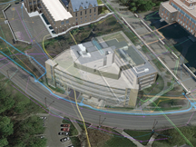
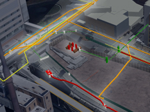
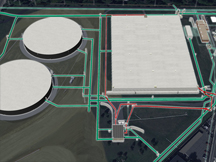
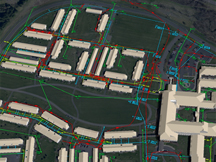
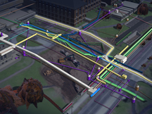
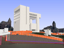
Subsurface visualization includes images of existing or proposed underground site constraints or work related to subsurface systems. Underground utilities are a feature of most any worksite at any scale. These subsurface conditions are normally not important enough to warrant attention in construction marketing visualizations. Certain projects feature tie-ins to existing underground systems. Systems within easements must be avoided. Campus related construction often requires some acknowledgement of a site utility system. Commercial, academic, and healthcare campuses are respectively increasingly fraught with underground utilities. At times, subsurface conditions must be amended → before any work can start. Some projects involve work that is primarily underground →. Subsurface work can be intimately related to terrain, thus, for the most demanding subsurface visualizations, an integrated worksite model is necessary. Subsurface visualization can be used to validate construction marketing strategy →. Not every project warrants acknowledgement of subsurface conditions, but at times, they are undeniably important to a given construction message.
Three flavors of Vinci SubVision™
Vinci LLC possesses three effective subsurface visualization methods.
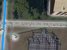
Vinci SubVision Trace™. From the earliest of its construction visualizations in 2004, Vinci LLC has produced SubVision Trace™, indicating site utilities in presentation software, overlaying them atop an ortho or oblique aerial view of a worksite. These can be toggled on or off →, can be systemic, and can schematically depict alterations to the system. This is a useful technique when site utilities need to be acknowledged, but not enough is known about how they’ll interact with proposed construction. The Trace method is not as flexible as the other two methods. It is not intrinsically consistent; changing a view will not generate a new representation of subsurface utilities in the new view. Trace is a rapid and economical way to indicate site utilities in a construction interview presentation.
SubVision Xray™ developed around 2008 along with GIS integration in the Vinci Digital Worksite™ service. The “Xray” method is more flexible than Trace, a part of Vinci’s worksite model, and is still economically produced. Like Trace, Xray can portray existing or proposed underground utility systems diagramatically, but on a vaster scale and consistent across all visualization produced for a given project. (Examples: 1 →, 2 →). Phasing of enabling work → can be portrayed using Xray. If you are wrestling with a large campus and only need a general, diagramatic acknowledgement of an underground utility system, SubVision Xray is right for you.
Vinci SubVision Solid™ involves digitally modeling underground utilities and integrating the model as part of Vinci’s Digital Worksite™ service. It is the most flexible method of illustrating interaction of construction with underground utilities and objects. SubVision Solid™ is normally part of an integrated digital worksite model, making any 4d visualization output intrinsically consistent. It can be used to illustrate underground conditions over a large scale →, though is more labor intensive and perhaps less economically efficient than Xray for large areas. Complex relationships (1 →, 2 →) and interactions between subsurface systems, temporary maneuvers, and proposed work are feasibly rendered through Vinci SubVision Solid™.
Requirements
To produce subsurface visualization, a survey and a civil set describing any alterations are ideal. Schematics can be used, especially for the diagrammatic representations. Higher definition basis documentation will require more diligience. The most important requirement for applying subsurface visualization to your next project is purpose, especially when considering digitally modeling the underground structures.
This page last modified Tuesday 13 March 2018.

