 |
Vinci A8B46College Campus Terrain Dataset |
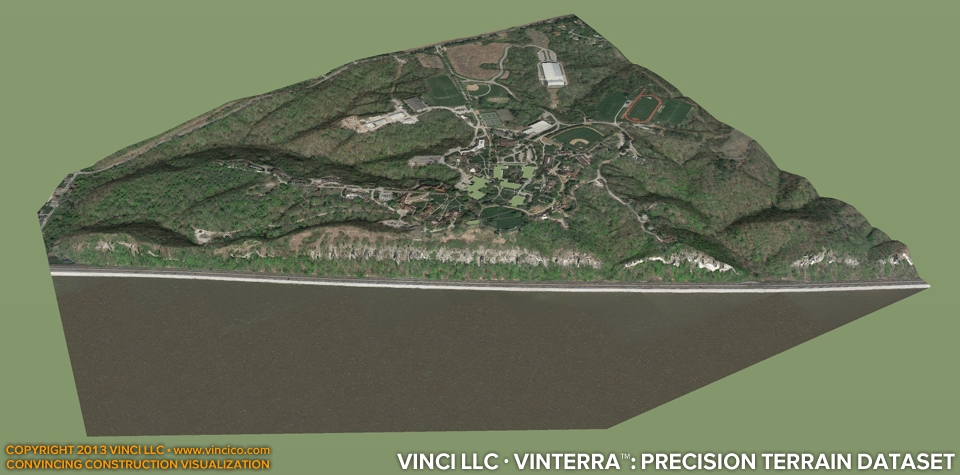
Vinci VinTerra™ | High Resolution Digital Terrain Model
Vinci VinTerra™ digital terrain models feature custom terrain based on your project’s basis documentation (surveys, civil drawings). Resolution varies between 2 and 6 inches per pixel for most sites depending on the resources available; Vinci’s standard is 5 inches per pixel. Up to 100 acres of existing terrain can be produced within one to three working days, depending on topography. Larger sites can be built and may require more time. Vinci LLC can also produce proposed landforms, and does produce temporary excavation, cuts, and fills in its Digital Worksite™ service. This VinEstate™ example measures 640 acres (476 acres of land.)
See details of this model here.
If bathymetry (underwater terrain) is significant; Vinci LLC can model it, provided a dataset describing it. See bathymetric models here: a8226, a82a4-11.
This page last modified Monday 29 April 2013.