 |
Vinci A90B1Off-Campus Student Housing |
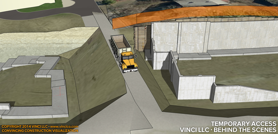
Vinci · Behind the Scenes | Temporary Access.
Vinci LLC’s VinTerra™ digital terrain models use civil survey data when available to simulate the surface of the earth at your worksite. Combined with any bank retention schematics and your layback or excavation directives, Vinci LLC can model your excavation so you can better gage site access. This image shows that the running assumption for layback may jeopardize construction access between the left and right apartment blocks. The team was able to reconsider their assumptions and achieve more secure access on site.
This page last modified Thursday 31 July 2014.